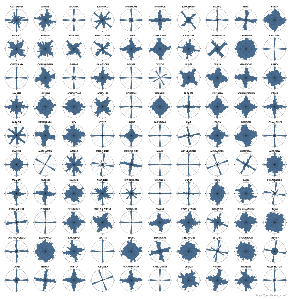
I recently saw the nifty infographic at left.
What information is it displaying? (I'll post the answer at 4pm.)
This would never have fit on a name tag.
The Cartesian grid city is a relatively young phenomenon; of the cities in the chart, most of the tightly gridded ones are in the Americas or Australia, or had their big growth spurt in the late 19th to 20th century (like Beijing).
Solution
Each compass rose shows the orientation of all streets in the city. For example, San Francisco is mostly aligned with the cardinal directions, but also has a minority of NE/SE/SW/NW streets (e.g., around Proof School) plus a few scattered hills where the streets go every which way.
Congrats to solvers Peter V., Zach Z., Allison, Jacob C., Jackson, Graham, Zachary S., and Dan J.!
Until next time…
In addition, you can browse the archive of past online puzzles.